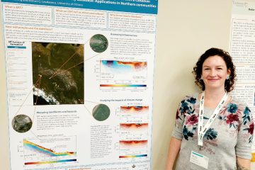
The October PermafrostNet seminar is being presented by Teddi Herring on Effective data sharing: Achievements and challenges creating the Canadian Permafrost Electrical Resistivity Survey Database. Date: 26 October 2022 Time: 13:00-14:00 Eastern Time Location: Zoom (details are posted in our Teams site).
New Seminar Coordinator
Taking over from Charles Gauthier as our new network seminar coordinator is Zakieh Mohammadi. Zakieh is a PhD student at the University of Calgary under the supervision of Professor Jocelyn Hayley. During her PhD studies, she will be working on developing a framework for evaluating and estimating the thaw-settlement behaviour of permafrost sediment.
Trail Valley Creek Research Station by Charles Gauthier
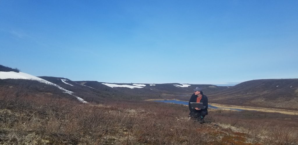
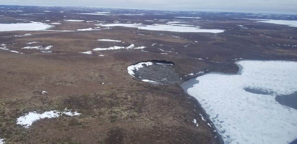
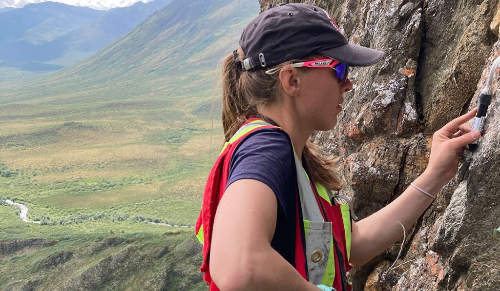
In early June, I had the chance to be part of a team of scientists heading to the Trail Valley Creek Research Station. Located a 30-minute helicopter ride away from Inuvik, NT, Trail Valley Creek supports many different long-term projects. My colleague, Vincent Graveline, and I were there for two weeks during which our goal was to launch weather balloons as part of Vincent’s MSc research on planetary boundary layer dynamics. Attached to the balloons were detachable probes equipped with several instruments reading pressure, altitude and, most importantly, air temperature. Our goal was to observe the height of the planetary boundary layer in spring. The depth of the planetary boundary layer affects the land-atmosphere interactions, and its depth varies depending on land cover and atmospheric conditions. With the boreal tree line shifting northward, information on the planetary boundary layer over the tundra and a nearby forest stand will help to better understand the consequences of boreal treeline shifts on tundra-atmosphere interactions.
A typical day could be split in three parts: the launch of the balloon, the wait for it to climb to a specific, pre-determined altitude and the retrieval of the probe. We walked over 70 km in the tundra, a radio receiver in hand looking for the white probe the size of a styrofoam cup with a single flashing LED light. This research trip allowed me to visit a changing arctic tundra research site where permafrost is rapidly thawing, a sight that I don’t normally see while modeling permafrost change from the comfort of campus. Science aside, the landscapes, the berries and the sneaky ptarmigans were worth all the soreness in our legs!
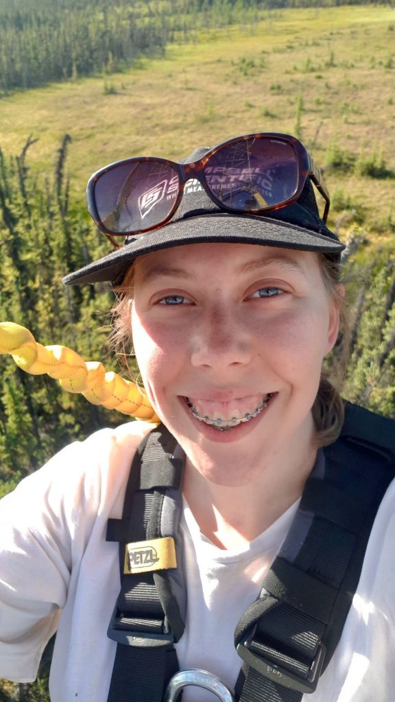
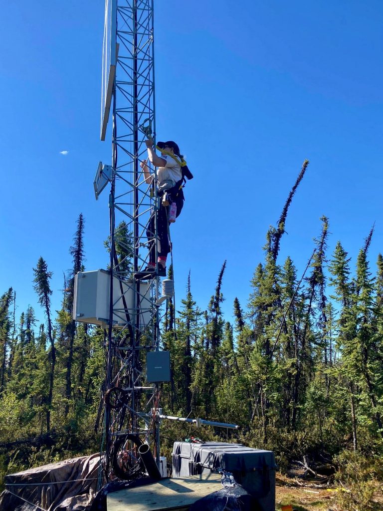
In August, I went to the Scotty Creek research station in the Northwest Territories. As a modeler, being able to go to the field was a great opportunity: it allowed me to better understand one of the sites I am trying to model.
The goal of my project is to simulate the climatic conditions of higher latitude regions, often underlain by permafrost, in a more accurate way. To achieve this, I will be including mosses in CLASSIC, the Canadian Land Surface Scheme Including Biogeochemical Cycles, as a plant functional type. Seeing Scotty Creek improved my understanding of just how much mosses are important in northern regions.
I was in Scotty Creek to help with a drone data collection project: I climbed an eddy covariance tower to ensure there was always someone who could see the drone, while the drone pilot was back in camp. This allowed me to see the drone above the trees.
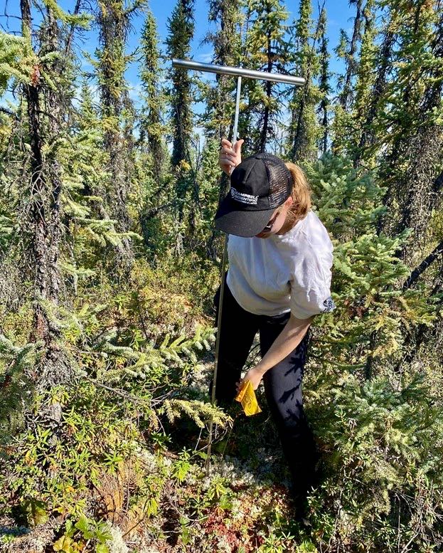
I also took active layer depth measurements around the eddy covariance tower. This allows us to monitor permafrost thawing, which happens rapidly at Scotty Creek. We can see the impact it has on trees at the limit between the forested permafrost plateaus and the permafrost free bogs: they start to tilt from the instability of the ground.
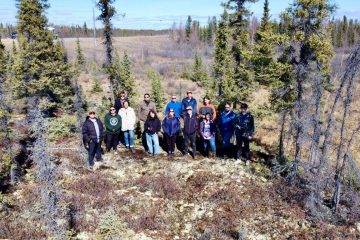
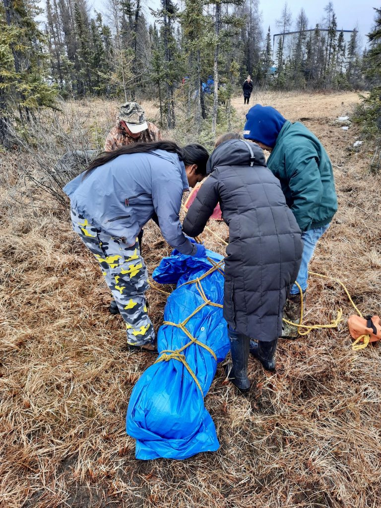
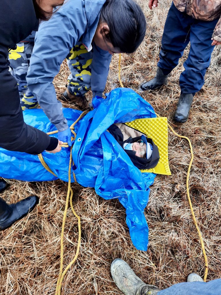
For several scientists and students, the highlight of research is fieldwork. Sometimes, to produce high-quality data in permafrost-related research, the study sites can be isolated. Now, they are not only remote because they are north (from a southerner’s perspective), but rather because they are secluded from the communities. For instance, the Trail Valley Creek (TVC) research station is situated north of Inuvik, NWT, in the middle of the tundra. As field season is extremely busy and dense, the researchers rarely have time to exchange and connect with local communities. They live and work out of the research station for most of the time they spend in the region. This poses the issue of creating a gap between researchers and community members. Indeed, it feels counterintuitive since research’s primary goal is to inform decision-making and produce tools to build resilience for local communities.
In the past year, thanks to funding from Future Skills Center, NSERC PermafrostNet, IVADO and other sources, the situation is in remediation. During our fieldwork in TVC, my colleagues and I had the opportunity to work with several members of the community. One of our colleagues, Camellia, planned a marvellous barbecue with family and friends from Inuvik and, at last, scientists were stepping out of the research station and into building relationships with folks from the community. These kinds of activities and partnerships at the sites are concrete steps towards crafting research projects for, and with, the community and ultimately bridging the gap between scientists, students, and community members.
Finalizing a “nested” Arctic tundra flux set-up by Oliver Sonnentag
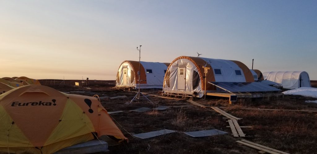
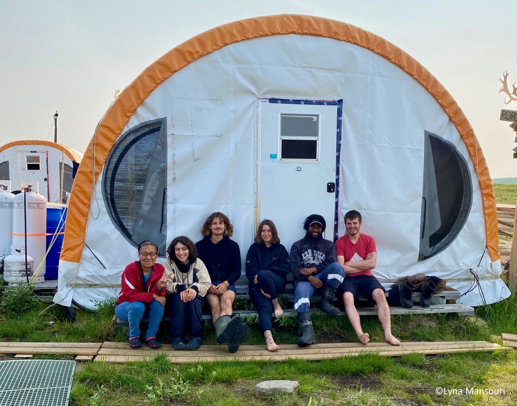
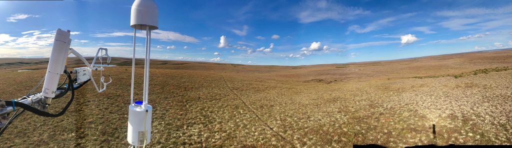
After several years of planning, and delayed by the Covid-19 pandemic, the Sonnentag lab completed a “nested” Arctic tundra flux set-up (landscape > ecosystem > plot) at Trail Valley Creek Research Station near Inuvik, NT. The flux set-up comprises three eddy covariance (EC) towers, and automated and manual chamber systems. The 20-m landscape EC tower measures net carbon dioxide, methane, and latent and sensible heat exchanges between the terrestrial-aquatic landscape (including extensive shrub patches) and the atmosphere. Given prevailing wind characteristics, nested within the landscape flux footprint (i.e., the temporally varying source area) are a 5-m and a 7-m ecosystem EC towers, one “seeing” fluxes originating from polygonal tundra, or, depending on wind direction, a small lake, and one “seeing” fluxes originating from mineral upland tundra, respectively. Nested within the ecosystem flux footprint (mineral upland tundra) is a custom-made chamber system to measure plot-scale net carbon dioxide and methane exchanges. The system comprises 18 automated chambers (nine ‘transparent’ and nine ‘opaque’ chambers), each with three replicates for three distinct plant communities: dwarf shrub, tussock, and lichen cover. Manual chamber measurements are collected from additional plant communities and land cover types (e.g., polygonal tundra and lakes). The chamber measurements are complemented by ancillary measurements of air and soil temperature, photosynthetic photon flux density, active layer depth, plant community composition, spectral characteristics, greenness, and soil moisture, temperature, and oxygen. Additional measurements to understand the underlying biogeochemical processes governing the carbon dioxide and methane sink-source behaviour: soil physical-chemical properties and gas profile dynamics, isotopic signal of d13C in soil carbon dioxide and methane, soil pore water and lake nutrient concentrations, quality and microbial degradability of aquatic dissolved organic matter and microbial community composition. The goal of these comprehensive observations is to shed light on how tall shrub encroachment affects vegetation diversity and associated surface-atmosphere interactions across scales in the Southern Arctic ecozone of western Canada.
Community training workshops in the NWT: Yellowknife (2 – 13 May) and Inuvik (6 – 9 September) by Oliver Sonnentag
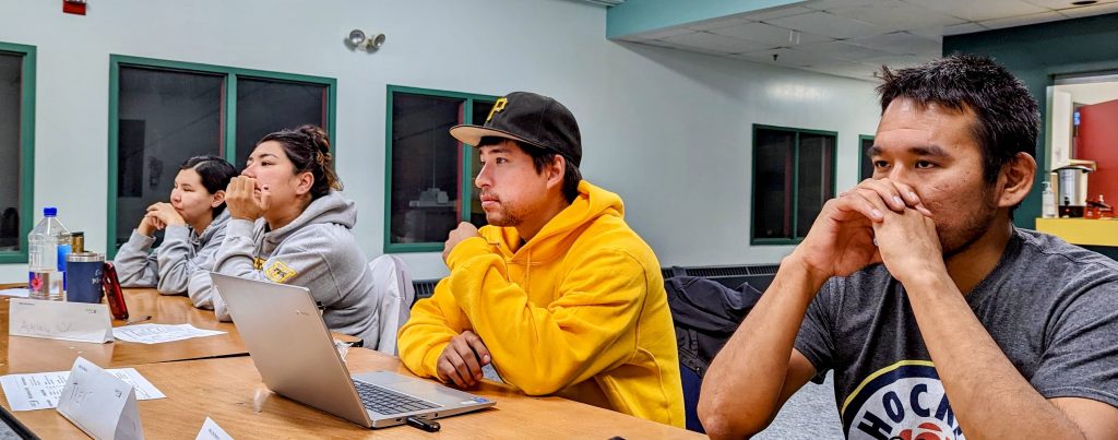
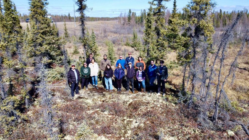
The Sonnentag lab hosted two community training workshops this summer. With 15 (Yellowknife) and 10 participants (Inuvik), both workshops were well attended. Primarily funded through the Future Skills Centre, the first week of the workshop in Yellowknife included safety certifications for wilderness first aid, fall protection and wildlife awareness. The second week focused on hands-on training in micrometeorological instrumentation and scientific instrumentation maintenance, used in combination with traditional experiences and perspectives.
Presentations, practical sessions and discussions were led by industry, academic, territorial government non-governmental organizations and Indigenous government representatives. The workshop in Inuvik was hosted through Sonnntag’s involvement in an IVADO-funded project on artificial intelligence, biodiversity and climate change. Presented by ASPECT-drone solutions, the focus of the workshop was on preparing participants for the Small Advanced Exam required by Transport Canada for advanced drone operation.
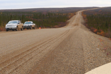
Permafrost subsidence is a big problem for northern roads. It can reduce their stability, cause cracks to appear, and if left unchecked may even render the roads inoperable.
Snow is an excellent insulator. Like a thick down jacket, it traps air in the pockets between the accumulated snowflakes, protecting the ground from cold air temperatures. When snow becomes compacted — by piling it up beside a road, for example — the air is squeezed out and the properties of the snow change to allow heat through more easily, like a thin windbreaker.
The goal of Patrick Jardine’s research is to improve the longevity and sustainability of infrastructure in permafrost regions by developing active snow management techniques for the purpose of reducing thaw subsidence along highways.
Collaborative solutions like the ones developed by NSERC PermafrostNet represent a shift toward a new generation of researchers who approach problems in a holistic way.
Read more about the permafrost research being conducted at Carleton University in this 3 minute article.
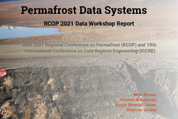
NSERC PermafrostNet hosted a data systems workshop at the 2021 Regional Conference on Permafrost, held online in October 2021. The workshop featured invited speakers Ashley Rudy from the Northwest Territories Geological Survey and Jeanette Nötzli from the Swiss Permafrost Monitoring Network (PERMOS). Attendees participated in breakout rooms and plenary discussion to identify current problems and limitations with permafrost data systems and to recommend how efforts can be better connected or coordinated. The final report summarizes the conclusions and provides a record of the interactions and discussions that occurred.
The workshop follows the 2020 Permafrost Data Workshop, which highlighted the importance of a community of practice and ongoing communication to improve the interoperability of permafrost data. In addition to the concrete objectives of identifying challenges and recommendations, the 2021 workshop was a way for members of the permafrost community to share ideas, and to cross-pollinate knowledge between sectors and disciplines of permafrost science.
“Climate change follows from increases in the atmospheric concentration of greenhouse gases (GHGs) such as carbon dioxide and methane. The concentration of these gases in the atmosphere was about 280 parts per million (ppm) before the Industrial Revolution and rose to 315 ppm by 1958. The value is now 418 ppm. There is no prospect of this concentration declining in the next 1,000 years, and it may well increase substantially before it stabilizes. It will take several decades to establish a carbon-neutral economy. Effective adaptation is going to be important if we are to maintain functioning overland transportation infrastructure, especially in permafrost regions.”
Christopher Burn, Carleton University
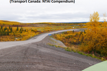
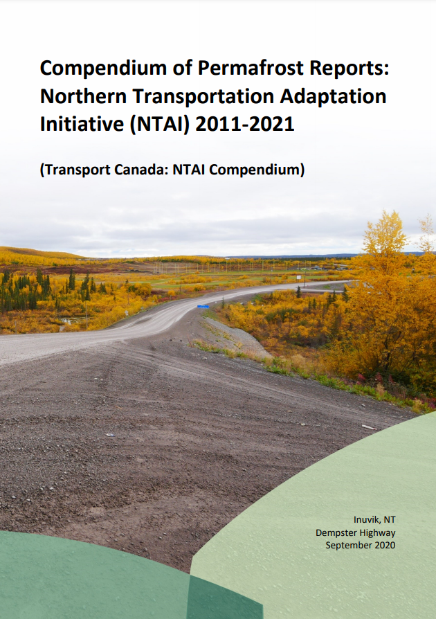
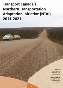
In practical terms, the climate change we are experiencing is irreversible. Now, a collection of 61 reports concerning the changing permafrost environment have been submitted to Transport Canada and expertly summarized in an important compendium.
The Northern Transportation Adaptation Initiative (NTAI) is a federal program designed to increase the capacity to adapt to climate change. Since 2011, NTAI has supported a wide range of research projects associated with highways and airports in northern Canada.
The compendium provides a comprehensive overview of permafrost research projects supported by the NTAI program from 2011 to 2021. The reports have been summarized and organized to provide convenient access to permafrost knowledge gained over the last decade. This an extremely important collection of research for the scientific and engineering communities, governments, industries, policy makers, students, and general public.
“Ground ice maps will ever only be as good as the data behind them.”
Michel Paquette, NSERC PermafrostNet Post-doctoral Fellow, Université de Montréal
Appel aux évaluations d’experts !
Nous cherchons à obtenir les commentaires et la validation des experts de la communauté canadienne du pergélisol sur la récente carte de la glace de sol du Canada.
La carte des conditions de la glace de sol (ground ice map of Canada – GIMC) (Geological Survey of Canada, Open File 8713) présente une nouvelle cartographie à l’échelle nationale des conditions de glace de sol au Canada. L’évaluation du GIMC s’inscrit dans le cadre des efforts continus visant à fournir un retour d’information général et à évaluer des domaines spécifiques du GIMC, ce qui contribuera à la production de la première version de la carte de base du potentiel de glace de sol et des conditions géotechniques du pergélisol au Canada (GRIPv1) par PermafrostNet du CRSNG. Nous aimerions connaître votre avis d’expert sur l’exactitude de la GIMC actuelle. Votre expertise est précieuse, car les connaissances sur la glace de sol sont plutôt rares; elles dépendent fortement des connaissances du terrain et sont donc dispersées dans toute la communauté du pergélisol.
Nous aimerions connaître votre avis d’expert. Veuillez visiter notre page web pour plus d’informations et pour accéder à notre questionnaire – GIMC page web.
Call for expert evaluations!
We are looking to get expert feedback and validation from the Canadian permafrost community on the recent ground ice map of Canada.
The Ground Ice Map of Canada (GIMC) (Geological Survey of Canada, Open File 8713) presents new national-scale mapping of ground ice conditions in Canada. Evaluation of the GIMC is part of the ongoing efforts to provide general feedback, and evaluate specific areas of the GIMC, which will inform the production of the first version of the Ground Ice Potential and geotechnical permafrost base map of Canada (GRIPv1) by NSERC PermafrostNet.
We would like expert opinions on the accuracy of the current GIMC. Expertise is highly valued, as knowledge on ground ice is quite rare and highly site dependent, and therefore scattered all across the permafrost community.
“The NTAI’s focus on climate change was distinctive and forward looking at the time. Now it is recognised as integral to long-term management of transportation infrastructure.”
Christopher Burn, Carleton University
Transport Canada’s Northern Transportation Adaptation Initiative (NTAI) is the first organized national program in Canada to address northern transportation infrastructure stability in anticipation of climate change. From 2011 to 2021, NTAI has helped northern agencies to prepare for challenges anticipated from climate change for transportation infrastructure built in the permafrost environment.
The NTAI contributed to several important developments in our understanding of climate change impacts on infrastructure and potential strategies to manage these effects. When the NTAI was conceived, the primary risk to the transportation network was considered to be from thawing and loss of embankment integrity. The research conducted through the program identified a range of other geohazards, especially derived from a more active hydrologic regime and from thermokarst development close to infrastructure.
Following the 2021 NTAI Annual Network Meeting Emma Stockton, Christopher Burn and Jen Humphries have compiled a special 24 page report on Transport Canada’s NTAI Program. You can download the report here.
“The NTAI has played a unique role in Transport Canada’s climate change agenda, influencing the way the department designs and implements programs, and helping to inform funding decisions. Northern jurisdictions own much of the transportation infrastructure in Arctic regions, and their active involvement in this program has helped target permafrost research to areas of most pressing need, ensuring the program’s continued relevance. Overall, the NTAI is a great example of how research/industry/government collaboration can drive policy change and action to enhance the climate resilience of transportation systems in Canada’s permafrost regions.”
Maxine Bilodeau, Director of Climate Change Adaptation & Planning for Transport Canada
“The event was a great opportunity to meet some of the new network personnel and work together to make progress on some of their data-related challenges. As PermafrostNet continues to develop I hope we can have more events like this.”
Nick Brown, NSERC PermafrostNet Data Scientist
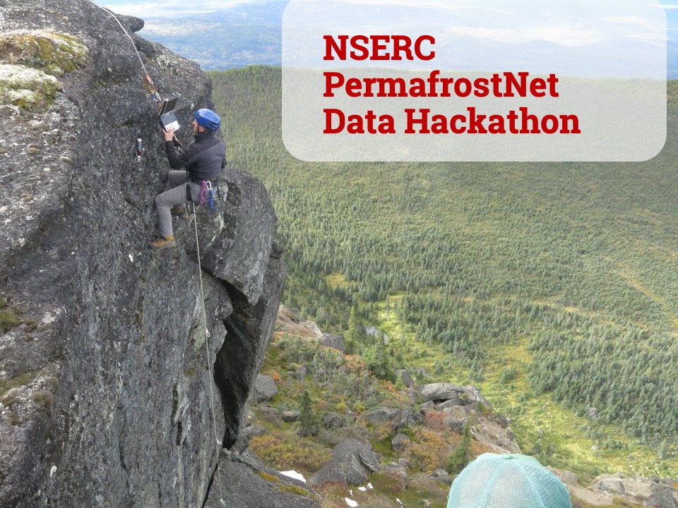
The first NSERC PermafrostNet Data Hackathon was held on August 19th, 2020, with fifteen researchers and data scientists getting together on Zoom to share best practices and discuss their latest challenges with data and coding.
The event was organized to support members of the network in creating metadata records and publishing datasets.
The event was kicked off with a presentation by Nick Brown (NSERC PermafrostNet Data Scientist), who outlined the plan for the days activities and presented an introduction to the resources available through NSERC PermafrostNet. You can download the Hackathon presentation here.
The day was broken up into sessions for group work in breakout rooms, discussions and Q+A opportunities for the participants. There was plenty of opportunity for everyone to network and talk with new members of the network and experienced researchers about the varied data challenges they faced. Many of the participants were new members to NSERC PermafrostNet, and in some cases permafrost data work. It was this opportunity to find people to share data issues and ask questions that was found to be the most valuable aspect of the Hackathon by the participants.
You can take a look at the day’s schedule and further details about the event on our 2020 Hackathon page.
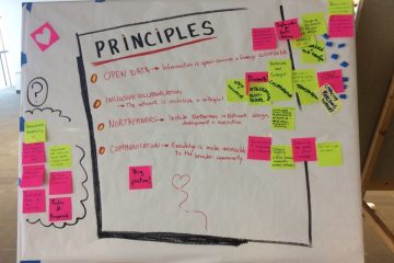
At NSERC PermafrostNet we firmly stand against racism, in solidarity with members of the Black community, as well as Indigenous Peoples and People of Colour, within our own network and beyond. We understand that strength comes from including, respecting, and celebrating diverse perspectives and backgrounds, and we are developing an Equity, Diversity and Inclusion (EDI) Committee to help foster a safe and inclusive environment where diverse voices are heard and valued. As NSERC PermafrostNet progresses, the Committee will be available to hear your EDI-related concerns, and will work together to put the training and tools in place to foster an inclusive environment for the community.