A snowy landscape with tracks in the snow, clusters of evergreen trees, a small cabin, and mountains in the background under a partly cloudy sky.

Seminar – 2 April – Ground Ice Detection with Spectral Induced Polarization.

Hosein Fereydooni will be presenting Ground Ice Detection with Spectral Induced Polarization.

Date: 2 April 2025
Time: 13:00-14:00 Eastern Time
Location: Zoom (details are posted in our Teams site).

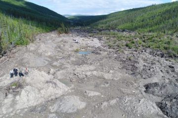
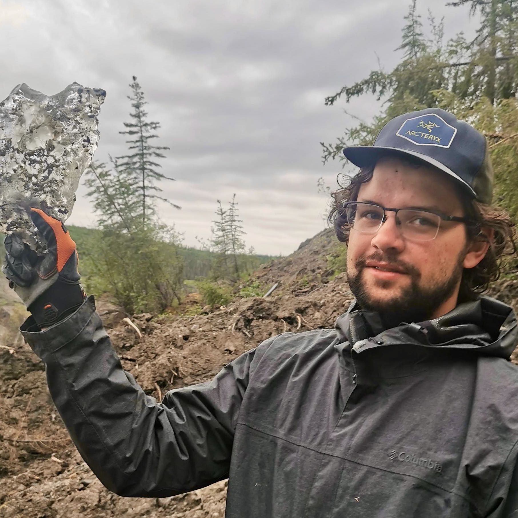
The melting of ground ice poses significant hazards in permafrost regions, leading to ground instability, infrastructure damage, and environmental changes. Detecting ground ice effectively is crucial for mitigating these risks, yet conventional geophysical methods—such as electrical resistivity, seismic surveys, and ground-penetrating radar—often produce ambiguous results due to the overlapping properties of frozen and unfrozen ground.

This presentation will explore the potential of Spectral Induced Polarization (SIP) as a more precise method for identifying ground ice. It will begin by discussing the theoretical foundations and mathematical principles of SIP, followed by an examination of various polarization mechanisms, with a focus on those specific to frozen environments, and an explanation of relaxation time. The study will then present field measurement results from a permafrost site in Yukon, demonstrating SIP’s ability to detect and distinguish ground ice in real-world conditions.

A person wearing a navy beanie, sunglasses, and a sweater takes a selfie on a snowy trail with equipment in the foreground and another person standing further down the path among bare trees.
By Tristan MacLean, ago
A person wearing a yellow shirt and blue beanie operates a remote control device on a sandy area with scattered bushes. A blue and orange drone landing pad is on the ground nearby, with trees and a blue sky in the background.

Seminar – 5 March – Improving predictions of permafrost conditions by using data from climate models that centres the impacts of permafrost thaw.

Galina Jonat will be presenting Improving predictions of permafrost conditions by using data from climate models that centres the impacts of permafrost thaw.

Date: 5 March 2025
Time: 13:00-14:00 Eastern Time
Location: Zoom (details are posted in our Teams site).

Permafrost predictions rely on models that simulate how the ground responds to changes in climate. These predictions are of limited use for local studies as climate model data does not capture small-scale variations and contains uncertainties and biases. While bias correction can improve how well the climate data matches local climate dynamics, these improvements do not always lead to improvements in the predictions of permafrost change produced by permafrost models.

In this seminar, Galina will introduce a new way to select bias-corrected climate model data based on how well it represents permafrost conditions. She will use examples from two sites near Inuvik to show how this approach can help reduce uncertainty and improve predictions about how permafrost will change over time.

A person wearing a blue jacket, gloves, and a hat smiles while making waffles on a stove in a rustic wooden cabin. A pot of batter, a blue mug, and a propane tank are nearby.
By Tristan MacLean, ago
Aerial view of Arctic tundra landscape with patches of brown and green vegetation, scattered small shrubs, a winding waterbody, and a blue sky with scattered clouds.

Seminar – 12 February – Post-Drainage Evolution of Wolverine Lake, Old Crow Flats, Yukon.

Danielle Chiasson will be presenting Post-Drainage Evolution of Wolverine Lake, Old Crow Flats, Yukon.

Date: 12 February 2025
Time: 13:00-14:00 Eastern Time
Location: Zoom (details are posted in our Teams site).

This presentation explores the post-drainage evolution of vegetation succession and basin morphology of a large lake that drained in Old Crow Flats prior to anthropogenic climate warming. Old Crow Flats is a large permafrost lowland undergoing rapid landscape change related to catastrophic lake drainage events and landscape-scale shrubification. While post-drainage conditions have been well documented in modern lake basins, little is known about the evolution from young basins to old. Danielle will present the results from her radiocarbon dated macrofossil analyses of the margin and centre of a drained lake basin. By reconstructing the history of vegetation succession and its associated permafrost conditions better comparisons can be made of past and present basin evolution.

A person wearing sunglasses, a cap, and overalls kneels outdoors, smiling and holding a large block of soil and moss in a grassy field. They appear to be working in an open, natural environment.
By Tristan MacLean, ago
A railway bridge crosses a snowy landscape surrounded by leafless trees and evergreens. Snow covers the ground and the bridge’s base, with train tracks running across the scene.

Seminar – 29 January – Understanding Frost Jacking Effects on Transportation Infrastructure in Permafrost Regions.

Natalie Arpin will be presenting Understanding Frost Jacking Effects on Transportation Infrastructure in Permafrost Regions: Insights from the Hudson Bay Railway.

Date: 29 January 2025
Time: 13:00-14:00 Eastern Time
Location: Zoom (details are posted in our Teams site).

The Hudson Bay Railway plays a crucial role in Canada by providing an all-season, land-based pathway to transport goods to Northern communities, but the diverse ground conditions, ranging from isolated to continuous permafrost, create significant obstacles in maintaining its operation. The presentation will discuss current efforts to improve understanding of how ground conditions affect railway bridges, with a specific focus on frost jacking.

A person in outdoor clothing stands on a large rock in front of a mountain landscape, with low clouds and patches of autumn foliage visible in the background.
By Tristan MacLean, ago
Aerial view of a river with light blue water curving along steep cliffs, bordered by a dense forest with patches of green and brown trees, and sandy, rocky shoreline areas.

Seminar – 22 January – Permafrost Terrain Disturbance Susceptibility in the Nacho Nyäk Tagé (Stewart River) Watershed, Yukon.

Frederic Brieger will be presenting Permafrost Terrain Disturbance Susceptibility in the Nacho Nyäk Tagé (Stewart River) Watershed, Yukon.

Date: 22 January 2025
Time: 13:00-14:00 Eastern Time
Location: Zoom (details are posted in our Teams site).

The Nacho Nyäk Tagé (Stewart River) watershed in the traditional territory of the First Nation of Na-Cho Nyäk Dun (central Yukon) is underlain by extensive discontinuous permafrost and locally highly sensitive to thaw. In addition to impacts from climate change to its ecology, geomorphology, and hydrology, this culturally important area is pressured by mining activities and their environmentally harmful practices. Timely community-led land-use planning is necessary to develop effective management, conservation, and adaptation strategies. My project aims to contribute assessments on the distribution and susceptibility towards permafrost terrain disturbances (PTDs) in the watershed to the undergoing land-use planning process.

A total of 277 PTDs including 80 retrogressive thaw slumps (RTSs) were mapped in satellite imagery to understand the current spatial distribution of thaw-induced geohazards in the watershed. PTDs are indicators of sensitive permafrost terrain that is likely to respond strongly to climate change. RTSs in particular are indicative of thawing ice-rich permafrost and have increased in frequency and activity. Along the banks of Nacho Nyäk Tagé, they are typically associated with ice-rich glaciolacustrine sediments or tills, as validated by field observations.

Terrain susceptibility towards PTDs was modelled using random forest machine learning at a 16 m spatial resolution and revealed distinct spatial patterns related to the physiography and climatic history of the region. Tenfold cross-validation resulted in an average AUROC of 0.89, indicating high accuracy of model predictions. RTSs are predominantly found on gentle, northwest to northeast-facing slopes and riverbanks consisting of fine-grained glaciogenic sediments from the late McConnell glaciation.

A young man with light brown hair and a short beard wears a headset and microphone, taking a selfie inside a small airplane cockpit. Sunlight comes through side windows, and equipment is visible in the background.
By Tristan MacLean, ago
A wide, rocky landscape with sparse vegetation, surrounded by green forested hills. Four people stand on a mound to the left, and a vehicle is parked in the distance near muddy pools under a partly cloudy sky.

Seminar – 15 January – Characterizing the setting and dynamics of permafrost mass wasting in the central Mackenzie Valley, Northwest Territories.

Joseph Young will be presenting Characterizing the setting and dynamics of permafrost mass wasting in the central Mackenzie Valley, Northwest Territories.

Date: 15 January 2025
Time: 13:00-14:00 Eastern Time
Location: Zoom (details are posted in our Teams site).

Permafrost landslides throughout the western Canadian Arctic have increased in magnitude and frequency over the past ca. 20 years in concert with climate drivers of permafrost thaw. This non-linear acceleration has intensified landslide processes and feedbacks, increasing the diversity of landforms that pose emergent risk and hazards to infrastructure, water quality, and soil carbon. This presentation uses field and remote-sensing observations to provide a regional framework to highlight the influence of permafrost setting, landscape history, terrain conditions, and climate drivers on variations in thaw-driven landslide mechanics. We describe a continuum of landslide activity with a process-form model that involves top-down and bottom-up thawing, intermediated by internal thermal degradation altering slope properties. This includes a novel slope failure style that involves detachment at the base of relatively warm and thin permafrost, resulting in rapid large-scale landslides in areas previously thaw-stable. Collectively, regional characterizations of permafrost landslide types and their dominant failure mechanisms are critical in anticipating areas susceptible to thaw-driven slope failure in the future.

A man wearing glasses, a dark jacket, and a cap holds up a large, clear, irregularly shaped rock or crystal outdoors in a wooded, muddy area under a cloudy sky.
By Tristan MacLean, ago
A river winds through a lush, green valley surrounded by rolling hills and forested slopes under a partly cloudy sky. There are rocky areas and patches of exposed earth along the water’s edge.

Victor Pozsgay wins CU-PSAC Postdoctoral Fellow Research Award

Using Simulations to Predict Landslides in Permafrost Areas.

The annual CU-PSAC awards event showcases and recognizes outstanding research achievements by Postdoctoral Fellows who are part of the PSAC Local 77000, the postdoctoral union at Carleton University.

A selection committee led by Graduate Studies reviews the applications and chooses the strongest twelve entries to compete at the event. The event requires postdoctoral fellows to present their research to an interdisciplinary panel of judges from across the University in 5 minutes.

The event took place on December 10, 2024 with Victor Pozsgay (Postdoctoral Fellow with NSERc PermafrostNet and in the Department of Geography and Environmental Studies) winning with his presentation – Using Simulations to Predict Landslides in Permafrost Areas.

You can see his presentation here:

By Tristan MacLean, ago
A person in outdoor clothing stands in a tundra landscape beside scientific monitoring equipment, taking notes on a clipboard. A black dog and a backpack are nearby under an overcast sky.

Seminar – 18 December – Measuring Active Layer Dynamics with InSAR.

Allison Plourde will be presenting Measuring Active Layer Dynamics with InSAR.

Date: 18 December 2024
Time: 13:00-14:00 Eastern Time
Location: Zoom (details are posted in our Teams site).

InSAR (Interferometric Synthetic Aperture Radar) is a well-established method for measuring small-scale surface deformations across vast regions. However, the influence of snow cover on InSAR phase limits the comprehensive tracking of seasonal dynamics in permafrost terrain. This study focuses on low-land permafrost near Inuvik, Northwest Territories, aiming to enhance understanding of permafrost active layer dynamics, particularly in winter. To tackle this, a multifaceted approach combining C-band and X-band InSAR measurements with in-situ data has been developed. Instrumentation at research sites includes inclinometers for vertical surface deformation, ultrasonic range finders for snow depth, and corner reflectors as InSAR references. This comprehensive approach aims to contribute valuable insights to the scientific understanding of permafrost monitoring techniques and addresses the impact of snow cover on InSAR measurements in permafrost terrain.

A person wearing a knitted hat and scarf smiles outdoors with a snowy landscape and mountains in the background under a bright, clear sky.
By Tristan MacLean, ago
Two women stand smiling on rocky ground at a construction or work site in a mountainous area. Other people, some in safety gear, observe the site; an excavator and forested hills are visible in the background.

Seminar – 4 December – A framework for evaluating thaw settlement.

Zakieh Mohammadi will be presenting A framework for evaluating thaw settlement.

Date: 4 December 2024
Time: 13:00-14:00 Eastern Time
Location: Zoom (details are posted in our Teams site).

Thaw settlement is a common challenge for infrastructure built on permafrost, leading to higher maintenance costs and reduced service life. This seminar will discuss the development of essential components for a comprehensive framework aimed at evaluating thaw settlement in permafrost regions—an important resource for northern infrastructure planning. Key highlights include a new qualitative approach for assessing thaw settlement potential using regional and national ground ice maps and inferred soil textures from geological data. A compiled dataset of thaw settlement test results, which has helped address gaps in thaw strain estimation resources, will be presented. This dataset enabled the development of new predictive tools, including methods for estimating thaw strain in coarse-grained sediments based on particle size distribution and for highly organic soils based on water content. Additionally, relying on this dataset, the seminar will cover comparative analyses of thaw settlement properties across different soil types and evaluations of existing thaw strain prediction tools. The newly developed tools and approaches, along with the insights gained, will inform the creation of the final framework, contributing to designing resilient infrastructure in permafrost regions.

A woman with long dark hair, wearing a light blue denim shirt and a gold necklace, stands in front of a background of vertical wooden slats. She is facing the camera and smiling slightly.
By Tristan MacLean, ago
A close-up of a hand holding a small, green moss plant with delicate, spiky leaves. The fingers and nails are dirty, indicating recent contact with soil or nature.

Seminar – 13 November – Modelling the nitrogen cycle of mosses across the boreal forest.

Rose Lefebvre will be presenting Modelling the nitrogen cycle of mosses across the boreal forest.

Date: 13 November 2024
Time: 13:00-14:00 Eastern Time
Location: Zoom (details are posted in our Teams site).

Mosses are common ground cover species in the boreal forest. They can influence different components of the ecosystem, such as the ground thermal regime due to their insulating properties, and the nitrogen cycle through biological nitrogen fixation. Mosses are not always included in terrestrial biosphere models, which are used to make climate projections. The Canadian Land Surface Scheme Including Biogeochemical Cycles (CLASSIC) was modified with the goal of improving productivity simulations across the North American boreal forest. Feather mosses and the nitrogen cycle of mosses were implemented in CLASSIC. The model was validated by comparing observation data against model output at eight sites. The sites range from being near the southern limit of permafrost to being in the continuous permafrost zone. Once validated, the model was run across the North American boreal forest.

A young woman with straight, shoulder-length blonde hair and braces smiles at the camera. She is wearing a green patterned top and standing indoors with wooden bleachers and people in the background.
By Tristan MacLean, ago